Mizar
-
Compteur de contenus
23 762 -
Inscription
-
Dernière visite
-
Jours gagnés
852
Type de contenu
Profils
Forums
Events
Gallery
Tout ce qui a été posté par Mizar
-

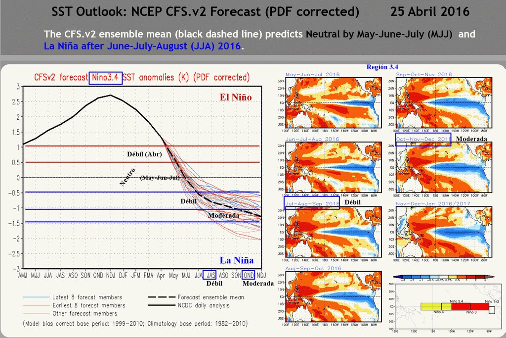
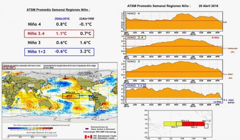
Enso 2016-2017. La suite d'un Nino ? ou la naissance d'une Nina ?
Mizar a répondu à un(e) topic de Mizar dans Discussions générales
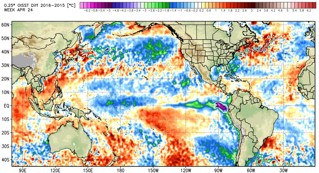
La différence des anomalies entre 2015 - 2016 pour la même période.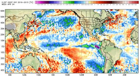
-
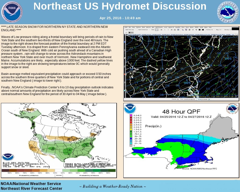
Observations du 25 avril au 1 mai 2016
Mizar a répondu à un(e) topic de Trapper dans Discussions générales
Pendant que je cherchais une autre chose, je suis tombé sur ceci... Un nid de Pygargue avec ces petits à un endroit quelconque au USA. Super http://www.ustream.tv/decoraheagles -
DISCUSSIONS PRÉVISIONS du 2 au 8 mai 2016
Mizar a répondu à un(e) topic de Trapper dans Discussions générales
...
-
DISCUSSIONS PRÉVISIONS du 25 avril au 1 mai 2016
Mizar a répondu à un(e) topic de Trapper dans Discussions générales
...
-
DISCUSSIONS PRÉVISIONS du 25 avril au 1 mai 2016
Mizar a répondu à un(e) topic de Trapper dans Discussions générales
..
-
Enso 2016-2017. La suite d'un Nino ? ou la naissance d'une Nina ?
Mizar a répondu à un(e) topic de Mizar dans Discussions générales
Donc si il me semble que la loi du 3 mois s'applique encore, nous devrions être mis officiellement en Nina d'ici fin-août-début septembre.
-
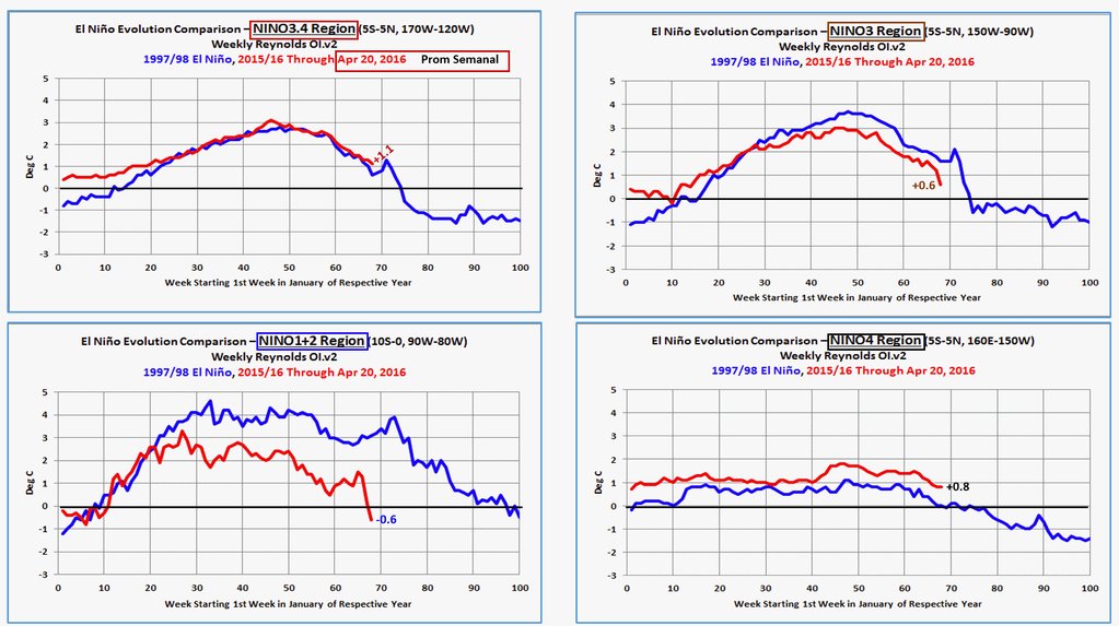
Enso 2016-2017. La suite d'un Nino ? ou la naissance d'une Nina ?
Mizar a répondu à un(e) topic de Mizar dans Discussions générales
Comparatif versus 2016 et 1998... région 1-2 c'est drastique et le reste devrait aller bon train aussi.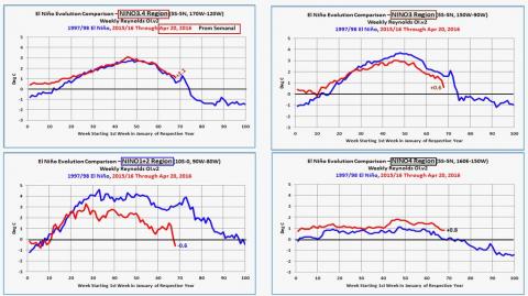
-
DISCUSSIONS PRÉVISIONS du 25 avril au 1 mai 2016
Mizar a répondu à un(e) topic de Trapper dans Discussions générales
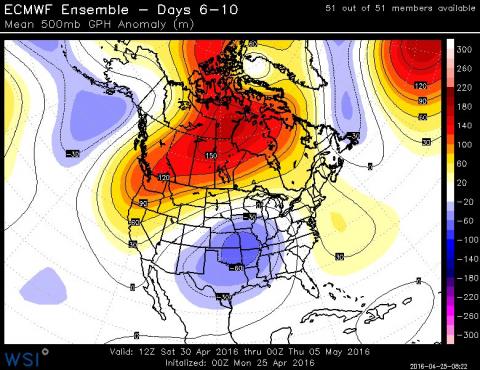
Omega block over North Atlantic, ridge over Greenland, troughs in NE Canada & Europe leading to wintry weather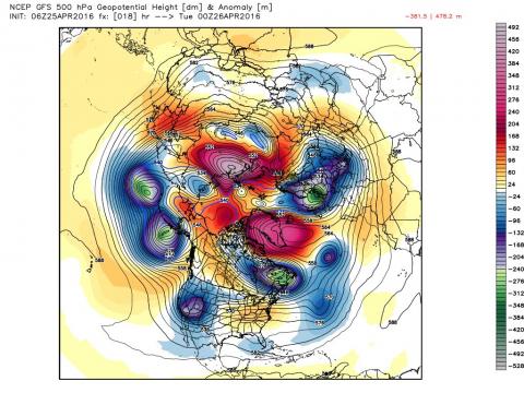
-
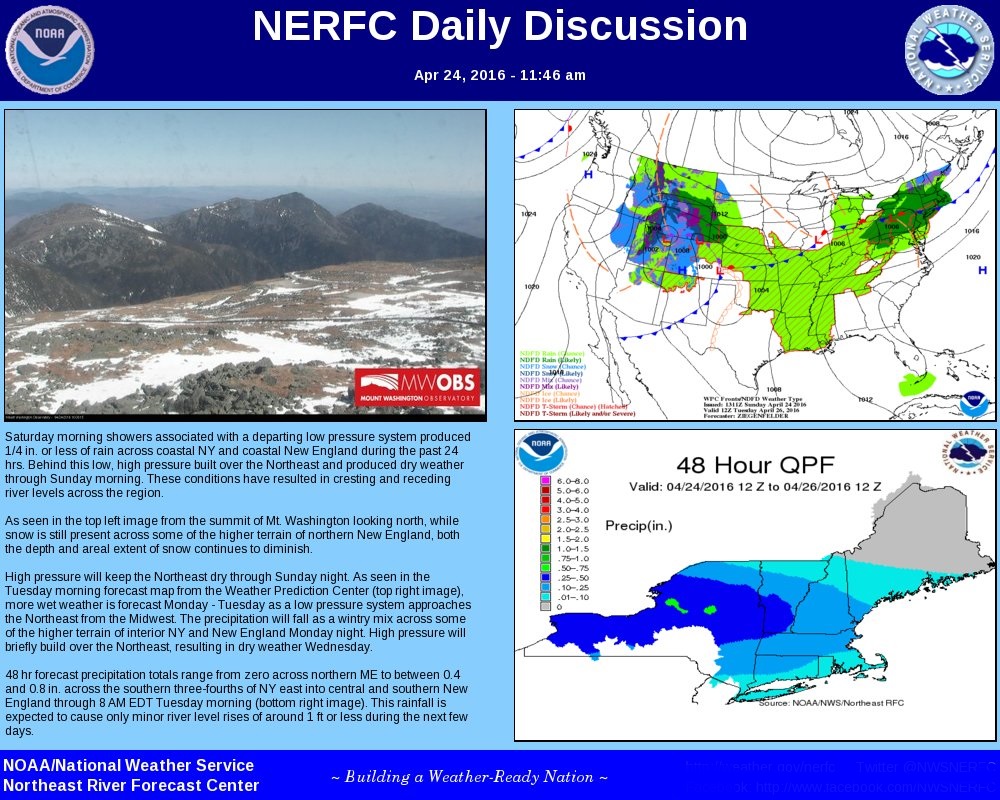
Observations du 18 au 24 avril 2016
Mizar a répondu à un(e) topic de Trapper dans Discussions générales
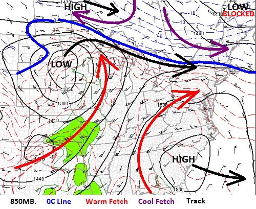
Souvenez de cette forte tempête de neige de la semaine dernière donc je parlais ici plus haut ? Elle dérive encore comme une âme en peine. Elle n'a pu remonter comme normalement cela se passe, le Jet pour se diriger vers la mer du Labrador. La ligne noir représente tout son parcours depuis maintenant plus d'une semaine et ce n'est pas fini... :-)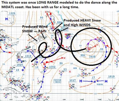
-
DISCUSSIONS PRÉVISIONS du 25 avril au 1 mai 2016
Mizar a répondu à un(e) topic de Trapper dans Discussions générales
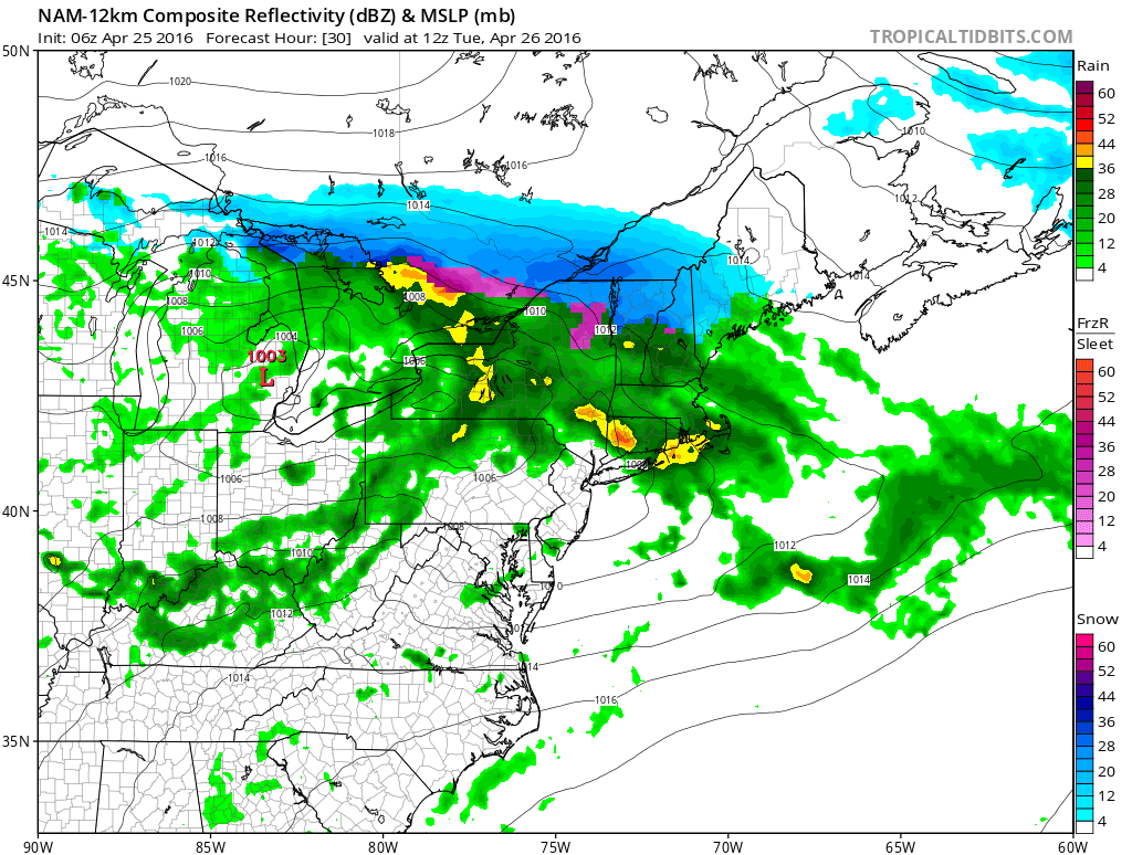
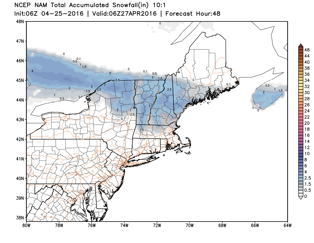
Un bon petit test pour le NAM d'ici les prochaines heures . Les accumulations possible au sol sûrement avec l'intensité des précipitations avec le déplacement du front.


-
DISCUSSIONS PRÉVISIONS du 25 avril au 1 mai 2016
Mizar a répondu à un(e) topic de Trapper dans Discussions générales
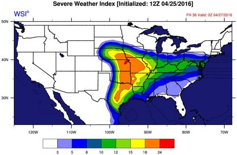
Un petit suivit pour le temps ''potentiellement sévère'' de cette semaine au USA. http://weather.graphics/gfs_2016042418_cape_conus2.gif -
Enso 2016-2017. La suite d'un Nino ? ou la naissance d'une Nina ?
Mizar a répondu à un(e) topic de Mizar dans Discussions générales
La suite...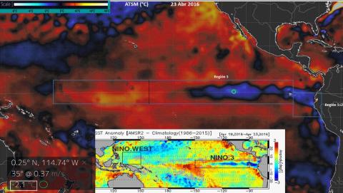
-
DISCUSSIONS PRÉVISIONS du 2 au 8 mai 2016
Mizar a répondu à un(e) topic de Trapper dans Discussions générales
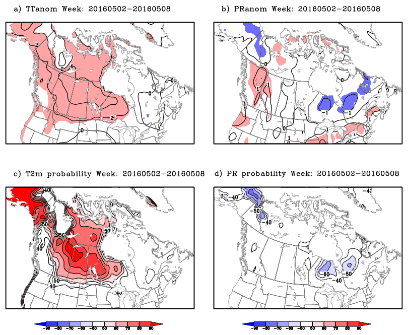
Grosso-modo, les grosses lignes pour le moment. Encore une fois, le gros des précipitations resteraient au Sud de la frontière. Signe que notre blocage tiendrait encore la route ? Peut-être mais il rentre en phase ou il commence semble-t-il a avoir un peu de plomb dans l'aile. Week 2: Monday May 02, 2016 to Sunday May 08, 2016 The upper trof domination off BC coast will favour upper south-westerlies spreading out above normal temperatures over Yukon and Northwestern territories and slowly eastward across eastern prairies to reach Northwestern Ontario by the end of the week. It will also favour wet conditions for most BC regions with an indication of low probability of above normal precipitations over Northern part of the province. We don't expect anymore above normal temperatures over the Lower Great Lakes regions as today model trend is to forecast central U.S. vortex further south. The above normal precipitation corridor over the lower Great Lakes looks doubtful as most main weather systems should move south of the international border. The anticipated cold low over the Atlantic regions will remain quasi-stationary all week and maintain near normal temperatures and precipitations.
-
DISCUSSIONS PRÉVISIONS du 25 avril au 1 mai 2016
Mizar a répondu à un(e) topic de Trapper dans Discussions générales
Severe Event Risk Management Weather Forecast issued Sunday April 24, 2016 by the Canadian Meteorological Centre of Environment and Climate Change Canada. Week 1: Monday April 25, 2016 to Sunday May 01, 2016 The forecast issued last Thursday are pretty well the same than the one issued this Sunday for week one. The upper weather pattern is characterized with a blocking system over northern Quebec moving gradually southward to reach the maritimes by the end of the week and a slow moving long wave ridge over the prairies. The cool Quebec vortex will maintain below normal temperatures and precipitations over most eastern half Canada provinces except by the end of the week over the Atlantic regions where a depression is anticipated in the vicinity of the Gulf of St-Lawrence bringing back near normal temperatures and precipitations.
-
DISCUSSIONS PRÉVISIONS du 25 avril au 1 mai 2016
Mizar a répondu à un(e) topic de Trapper dans Discussions générales
Severe Event Risk Management Weather Forecast issued Sunday April 24, 2016 by the Canadian Meteorological Centre of Environment and Climate Change Canada. Week 1: Monday April 25, 2016 to Sunday May 01, 2016 The forecast issued last Thursday are pretty well the same than the one issued this Sunday for week one. The upper weather pattern is characterized with a blocking system over northern Quebec moving gradually southward to reach the maritimes by the end of the week and a slow moving long wave ridge over the prairies. The cool Quebec vortex will maintain below normal temperatures and precipitations over most eastern half Canada provinces except by the end of the week over the Atlantic regions where a depression is anticipated in the vicinity of the Gulf of St-Lawrence bringing back near normal temperatures and precipitations. -
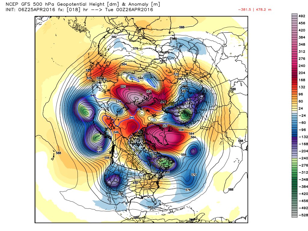
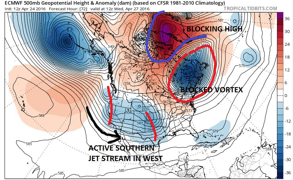
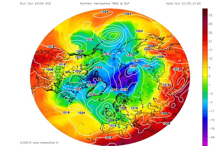
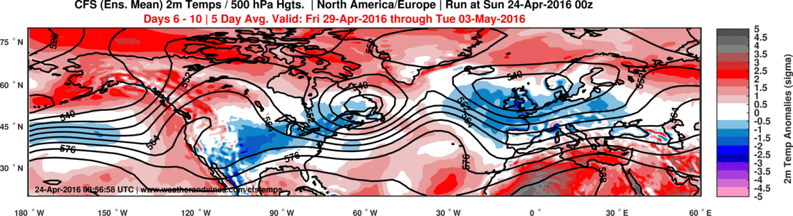
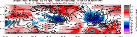
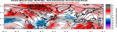
Et sur le GFS concernant l'hémisphère Nord, l'anomalie froide semble revenir vers nous en direction Ouest et faire une intrusion entre le Groenland et la Baie-d'Hudson.

-
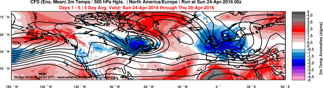
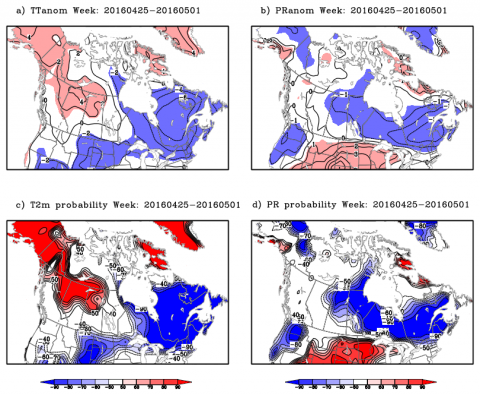
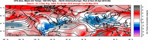
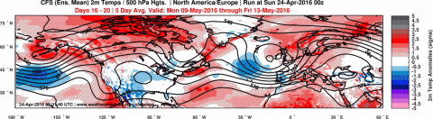
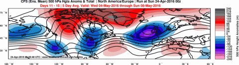
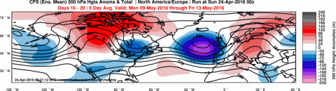
La même période maintenant mais concernant les 2 tm anomalie... pas de grands changements à l'horizon.
-
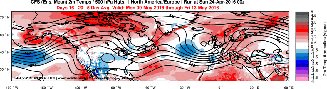
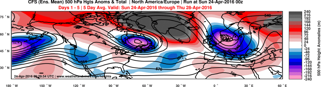
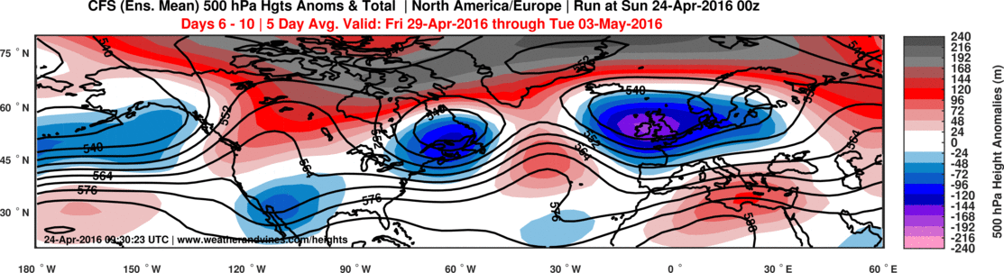
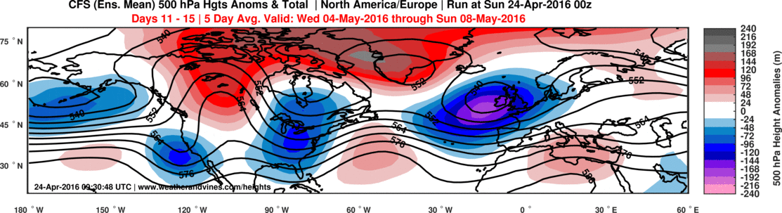
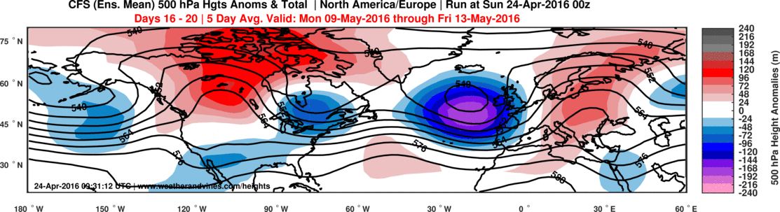
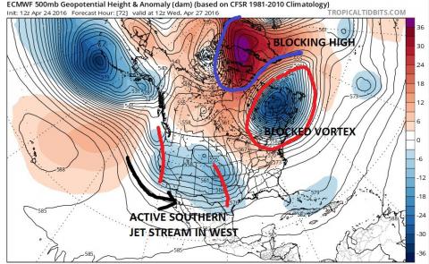
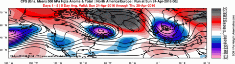
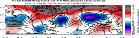
Les différents blocages à 500 hpa jusqu'à la mi-mai. Notre blocage Groenlandais est encore plus frappant en noir et il semble vouloir prendre fin justement vers la deuxième de mai mais encore là, faudra voir. Chose certaine, il finira bien par mourir un jour ou l'autre. :-)
-
Observations du 18 au 24 avril 2016
Mizar a répondu à un(e) topic de Trapper dans Discussions générales
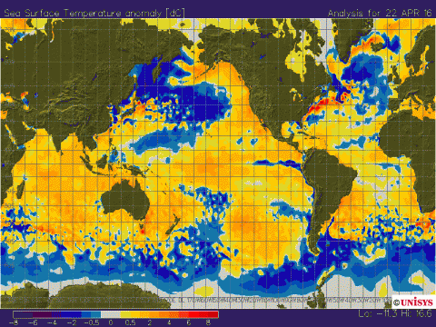
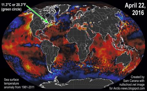
J'suis revenu voir cette anomalie au niveau du Gulf Stream plutôt.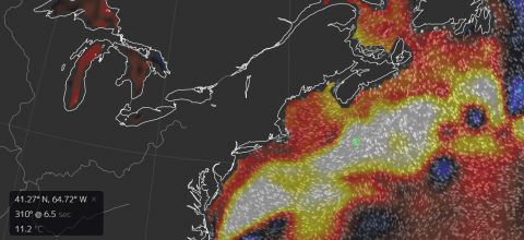
-
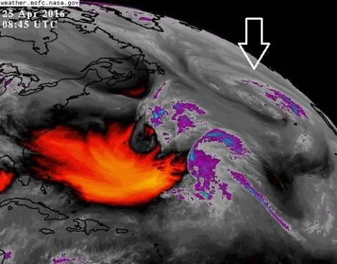
Observations du 18 au 24 avril 2016
Mizar a répondu à un(e) topic de Trapper dans Discussions générales
Quelques petites données ici et là à travers le globe...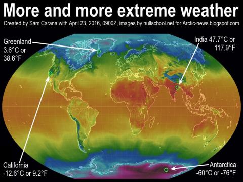
-
DISCUSSIONS PRÉVISIONS du 25 avril au 1 mai 2016
Mizar a répondu à un(e) topic de Trapper dans Discussions générales
Du temps potentiellement sévère à venir sur une partie des USA cette semaine...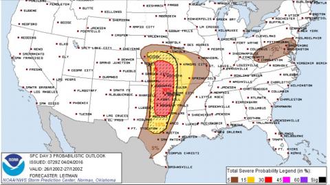
-
DISCUSSIONS PRÉVISIONS du 25 avril au 1 mai 2016
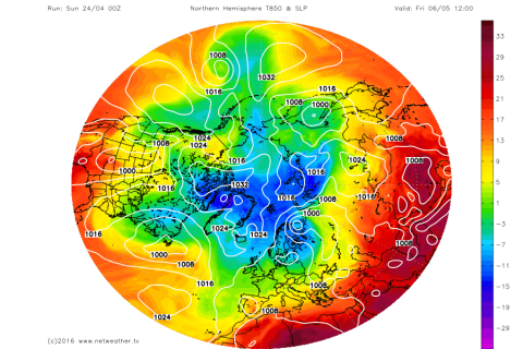
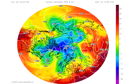
Mizar a répondu à un(e) topic de Trapper dans Discussions générales
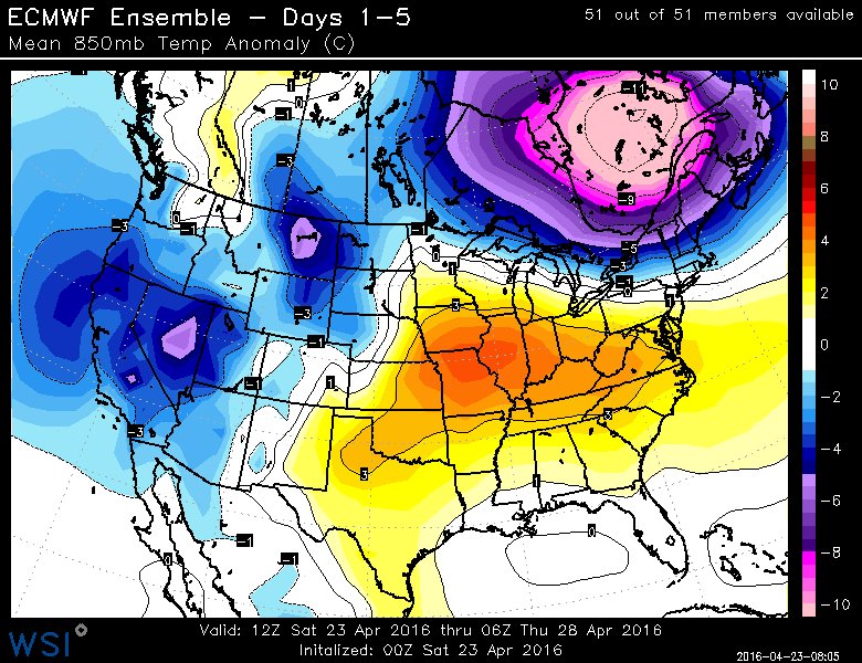
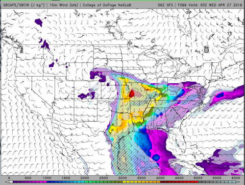
Quand même...la 850 hpa pour les prochains jours. Et c'est quand même bizarre pcq 'au moment même ou j'écris , il y a les criquets qui chantent dans les champs autour de chez-moi comme en plein été et disons que les nuits à venir, seront relativement sous le points de congélations à bien des endroits.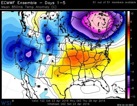
-
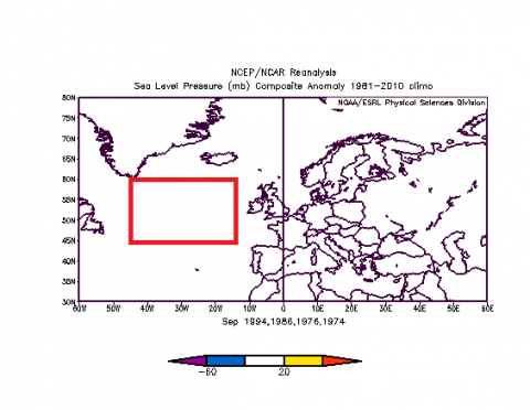
Absolument Zeus rien de pire dans ce cas. Disons que cette météo n'aide en rien une partie de l'Arctique qui souffre depuis déjà un bon moment.
-
...
-
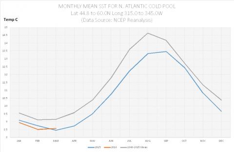
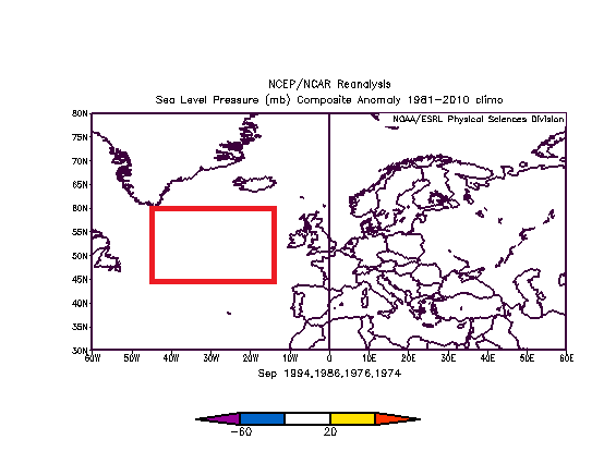
Petite mise à jour de notre anomalie de l'Atlantique Ce courant froid est en dessous de la moyenne depuis novembre 2014, donc sur une période de 17 mois.