Pooram
-
Compteur de contenus
6 197 -
Inscription
-
Dernière visite
-
Jours gagnés
141
Type de contenu
Profils
Forums
Events
Gallery
Tout ce qui a été posté par Pooram
-

Événement neigeux du 11-12-13 novembre 2019
Pooram a répondu à un(e) topic de Mizar dans Discussions générales
Eu, rien d'évident mais quand il y a ces amas nuageux à l'O des grands lacs et avec cette circulation, on peu s'attendre à quelque chose... Oui effectivement la passion vient de la; une sorte de rien se transforme en quelque chose - c'est même l'histoire de toute vies manifestes sur terre et de tout ce que fait l'humain... Il faut regarder plusieurs images satellites, cartes etc pour ce faire une idée au moins. Si non les modèles sont la pour çà !
-
DISCUSSIONS PRÉVISIONS du 11 au 17 nov 2019
Pooram a répondu à un(e) topic de beachcp31 dans Discussions générales
Donc pour les 8 prochains jours il y a deux bordées et ensuite retour aux normales ou presque ... Moi je surveille un autre évènement de vent possible dans l'autre période.. -
Observations du 28 oct au 3 nov 2019
Pooram a répondu à un(e) topic de beachcp31 dans Discussions générales
Je viens de sortir de cette tempête ! J'ai héberger du monde et c'était pas toujours drôle... surtout quand il y en a qui ont des gros dégâts; enfin c'est fini ! -
DISCUSSIONS PRÉVISIONS du 4 au 10 nov 2019
Pooram a répondu à un(e) topic de beachcp31 dans Discussions générales
Vendredi ouff - du 100 kh possible pour ici et la vallée du Rich. -
DISCUSSIONS PRÉVISIONS du 4 au 10 nov 2019
Pooram a répondu à un(e) topic de beachcp31 dans Discussions générales
La catastrophe c'est la glace avec le froid - donc les pluies. Juste le froid avec pas trop de neige pas trop de gros systèmes qui drainent la chaleur du sud et ensuite le froid du N. .... En passant les vents qui affecteront la Californie font partie du même paterne qui nous donnera le vents de vendredi comme vous savez. -
Observations du 28 oct au 3 nov 2019
Pooram a répondu à un(e) topic de beachcp31 dans Discussions générales
Papillons, mouches et insectes de toutes sortes ici. 17C et l'eau du fleuve (bassin La Prairie) est boueuse signe qu'il y a beaucoup eu de ruissellement. -
DISCUSSIONS PRÉVISIONS du 4 au 10 nov 2019
Pooram a répondu à un(e) topic de beachcp31 dans Discussions générales
Et un autre système possible avec vents violents autour du 6 - 7 nov. avec neige possible mais ça c'est une autre histoire et un autre connus -
DISCUSSIONS PRÉVISIONS du 4 au 10 nov 2019
Pooram a répondu à un(e) topic de beachcp31 dans Discussions générales
Ouais tout à fait ! De la flotte et du vents fort à violent dès le matin pour vendredi ici . Je me demande si il y aura un record de précipitation pour Oct. ?? En 2005 il y avait eu en oct. 198mm. ... on sera pas loin -----------bahh -
DISCUSSIONS PRÉVISIONS du 14 au 20 oct 2019
Pooram a répondu à un(e) topic de beachcp31 dans Discussions générales
À l'Île d’Orléans le vent NE à 70 avec rafales à 110kh possibles Pour ici, ben l'paysage va changer je pense - depuis vendredi passé c'est apogée des couleurs ... -
DISCUSSIONS PRÉVISIONS du 14 au 20 oct 2019
Pooram a répondu à un(e) topic de beachcp31 dans Discussions générales
La période des grands vents va pouvoir commencer. -
DISCUSSIONS PRÉVISIONS du 7 au 13 oct 2019
Pooram a répondu à un(e) topic de beachcp31 dans Discussions générales
Bien silencieux ici malgré tout ce brassage au sud et à l'O... -
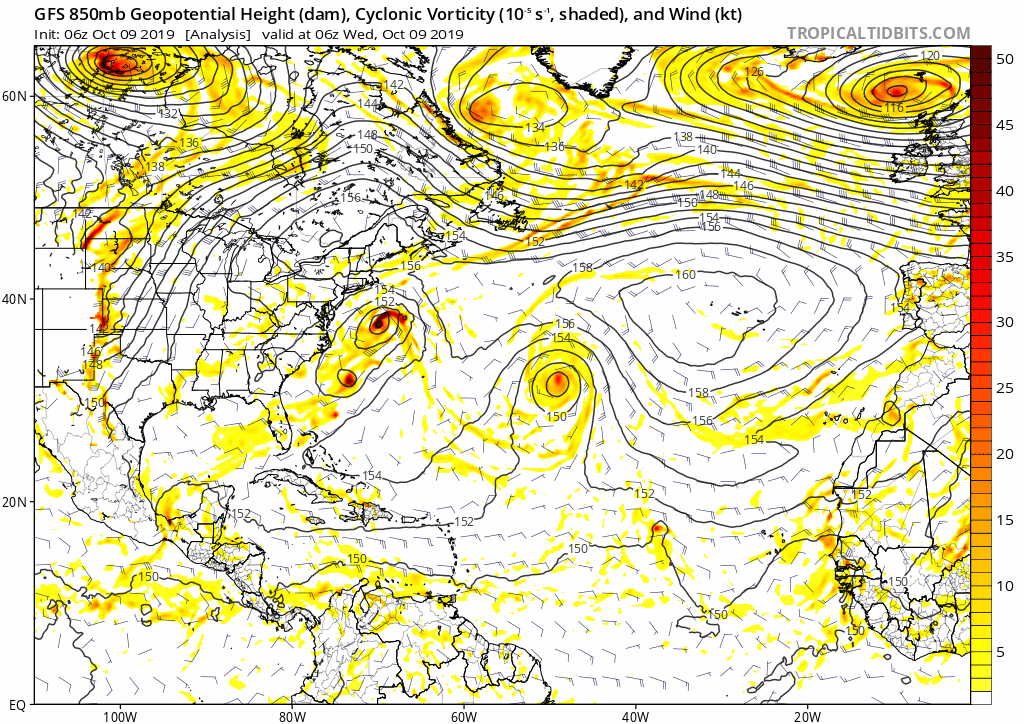
91L et hier soir 92L avec 30% À voir mais çà devrait être avalé tout çà par notre premier L Cutter
-
DISCUSSIONS PRÉVISIONS du 7 au 13 oct 2019
Pooram a répondu à un(e) topic de beachcp31 dans Discussions générales
Je ne sais pas pourquoi je parlais de "sens opposé"... ? Maintenant en plus d'avoir 91L on a aussi, au N E des Bahamas; 92L ... 30% mais je ne pense pas qu'il soit nommer - à voir... Et si je peux me permettre, ceci: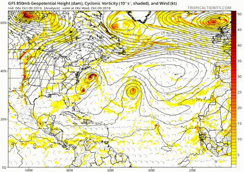
-
DISCUSSIONS PRÉVISIONS du 7 au 13 oct 2019
Pooram a répondu à un(e) topic de beachcp31 dans Discussions générales
Je me demande si il ne pourrait pas y avoir interaction avec 91L en sens opposé et nous faire une tempête impolie pour les préparatifs de l'Halloween ... Souvenir de 1991...
-
DISCUSSIONS PRÉVISIONS du 7 au 13 oct 2019
Pooram a répondu à un(e) topic de beachcp31 dans Discussions générales
C'est quoi l'histoire de MM avec depuis plusieurs jours: Des États-Unis au Canada, des millions de personnes auront une mauvaise surprise. Détails ici Je sais, on va tous recevoir une lettre de mise en demeure pour ne pas aller sur le site de MM... --- --- --- --- --- ----- -
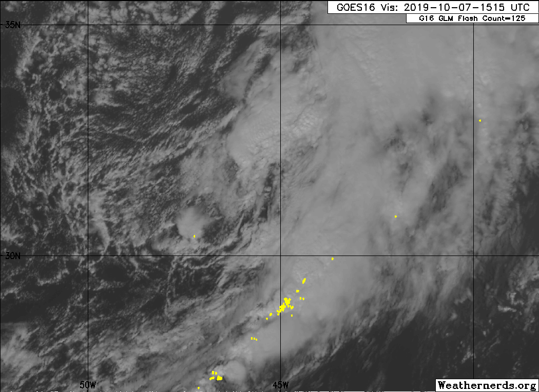
91L - 50% tout de même... le shear va relâcher j'imagine... Un gif -
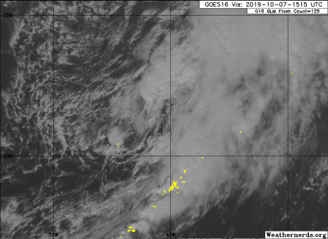
-
Observations du 7 au 13 oct 2019
Pooram a répondu à un(e) topic de beachcp31 dans Discussions générales
Non, je r'commence: Belle semaine à venir avec vents légers pour prolonger les couleurs, ce qui est très apprécié . -
Observations du 7 au 13 oct 2019
Pooram a répondu à un(e) topic de beachcp31 dans Discussions générales
Dave: "Environ 1,5 cm de neige lourde au sol. Ça ajoute de la lumière" Moi: " La venue de l’automne nous rapproche du printemps; SOURIEZ !" Bel automne, si vous me permettez cette observation saisonnière. Belle semaine à venir avec vents légers ce qui est très apprécié pour prolonger les couleurs. -
Observations du 30 sep au 6 oct 2019
Pooram a répondu à un(e) topic de beachcp31 dans Discussions générales
Un arbre sur 10 a quelques feuilles jaunes... hum,; ici Non je blague, mais c'est plus avancé que l'an passé - 10 - 15 jours; donc plus normal... -
Les rapports commencent à entrés: Le port de Flores est complètement détruit https://www.youtube.com/watch?v=Kk6Pf1lRWrU
-
Flores est frappé durement... ok, video très "populaire" mais avec données somme toutes véridiques j'imagine...
-
Et plus approfondi: Notez pour l’Angleterre Lorenzo et les Caraïbes dans quelques jours...
-
Les Açores vont, selon celui ci, être frapper de plein fouet et plus fort que l'on avait pu prédire...
-
Observations du 30 sep au 6 oct 2019
Pooram a répondu à un(e) topic de beachcp31 dans Discussions générales
En tous cas moi chu pas coupable, j'en avais pas --------- mais j'avais un galaxy 500 vert laid pour mourir... j'ai trouvé une photo sur le web: Le mid west va y goûter aujourd'hui et demain jeudi; tornades au menu...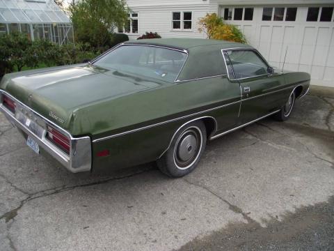
-
Observations du 30 sep au 6 oct 2019
Pooram a répondu à un(e) topic de beachcp31 dans Discussions générales
Regarder ça le 14 juillet 1987 https://ici.radio-canada.ca/nouvelle/1045083/30-ans-deluge-montreal-pluie-inondations-14-juillet-1987