Mizar
-
Compteur de contenus
23 814 -
Inscription
-
Dernière visite
-
Jours gagnés
858
Type de contenu
Profils
Forums
Events
Gallery
Tout ce qui a été posté par Mizar
-
Bien bonne idée et cela fait parti du processus naturel des saisons. Effectivement, les premier signaux montrent un mois de Mars passablement actif mais chose moins certaine, c'est l'entente des températures.
-

Observations du 13 au 19 fév 2017
Mizar a répondu à un(e) topic de beachcp31 dans Discussions générales
Etk pour en revenir vers chez-moi, il neige toujours ( faiblement mais en continu) depuis ma dernière observation et de petits cm qui se rajoutent. -5°C @ 14h00 pm bien pile. :-) -
Observations du 13 au 19 fév 2017
Mizar a répondu à un(e) topic de beachcp31 dans Discussions générales
Ça bin du bon sang !!!! Blizzard N-B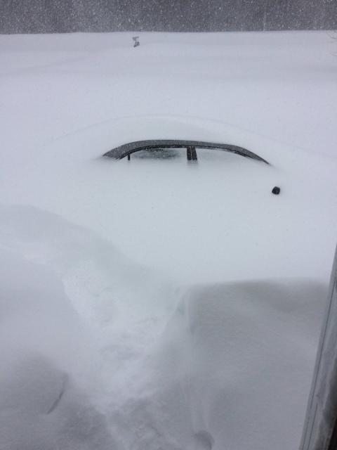
-
Observations du 13 au 19 fév 2017
Mizar a répondu à un(e) topic de beachcp31 dans Discussions générales
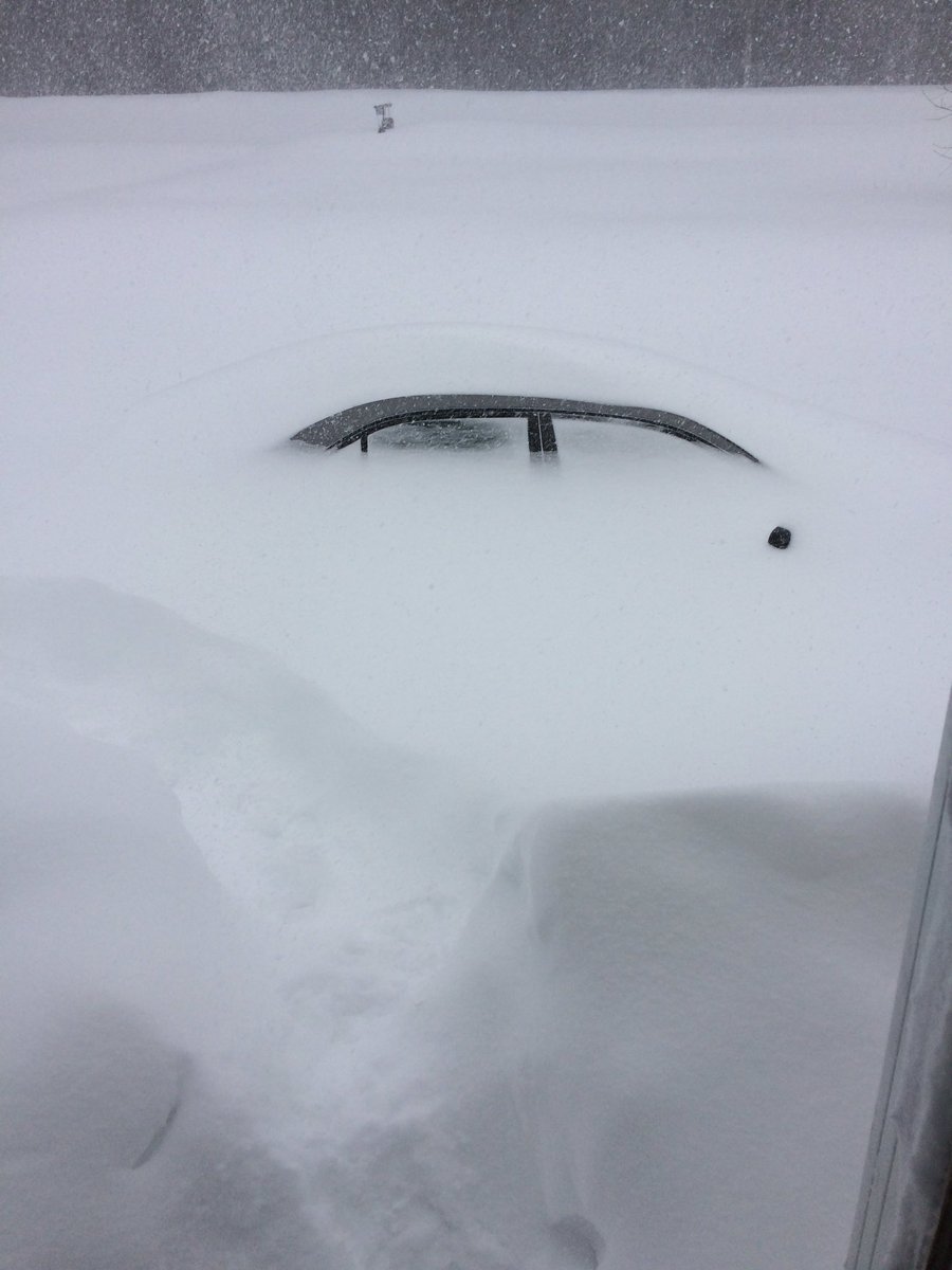
Crazy but beautiful snow-art. Almost as nice as our nose-art in the windows, right mum?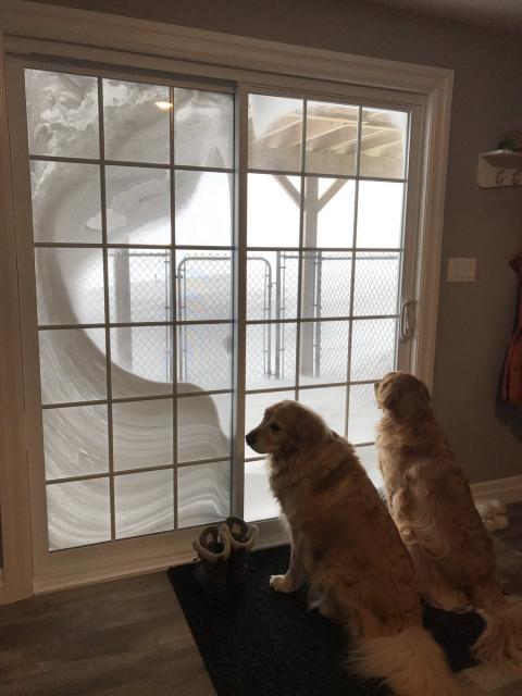
-
Observations du 13 au 19 fév 2017
Mizar a répondu à un(e) topic de beachcp31 dans Discussions générales
At 11h, 38cm in Gagetown and extensive blowing snow, hard to see neighbors... worst of the storm now and the next few hours ⚠️⚠️⚠️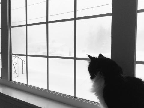
-
Observations du 13 au 19 fév 2017
Mizar a répondu à un(e) topic de beachcp31 dans Discussions générales
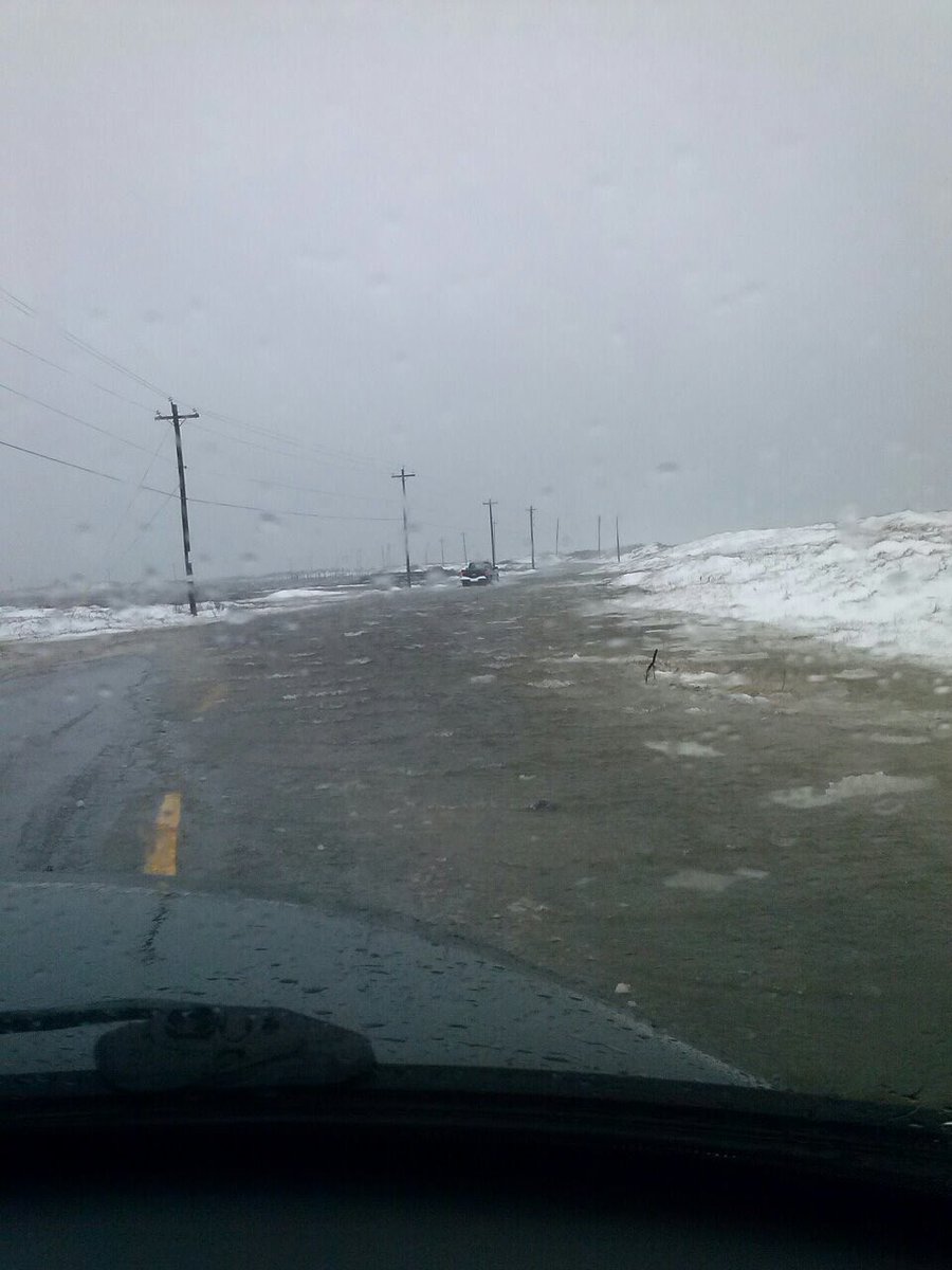
Storm surge in effect. Daniel's Head Road on Cape Sable Island. Melanie Swim photo.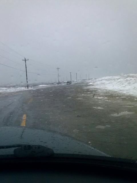
-
Observations du 13 au 19 fév 2017
Mizar a répondu à un(e) topic de beachcp31 dans Discussions générales
La neige a ''reprit'' un peu pus soutenue juste avant midi chez-moi... -6°C. -
Observations du 13 au 19 fév 2017
Mizar a répondu à un(e) topic de beachcp31 dans Discussions générales
Oui mais c'est une photo prise en noir et blanc de ce matin... Halifax et un lien pour de belles cams du N-Brunswick. Toute une tempête sur les cams du N-B http://nbcams.ca/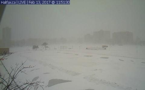
-
Notre Hiver Météorologique 2016-2017 .
Mizar a répondu à un(e) topic de Mizar dans Discussions générales
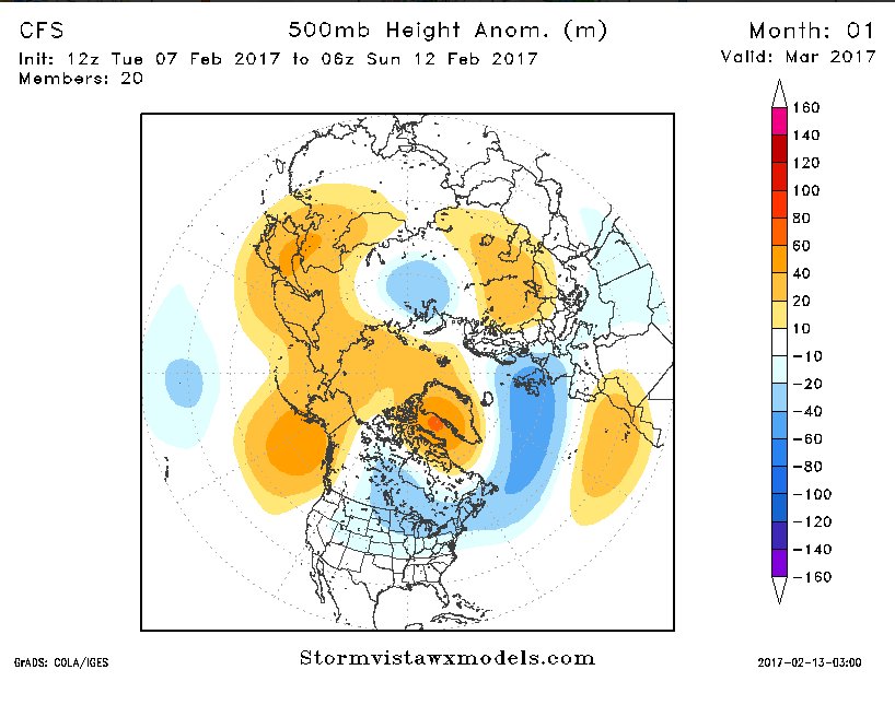
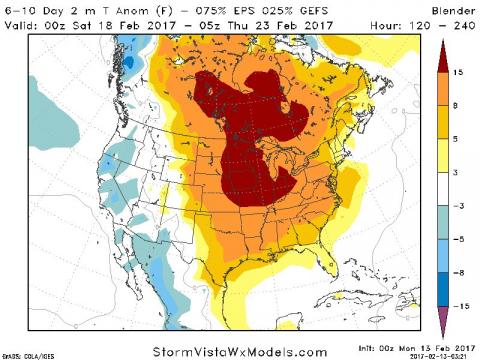
CFS pour Mars .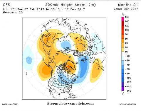
-
Observations du 13 au 19 fév 2017
Mizar a répondu à un(e) topic de beachcp31 dans Discussions générales
Plus d'une vingtaine de cm chez-moi aussi et il neige encore par intermittence et faiblement. -7°C @ 09h33 am. -
Observations du 13 au 19 fév 2017
Mizar a répondu à un(e) topic de beachcp31 dans Discussions générales
View from our NovaScotia GRC patrol... Qui essai de se rendre sur un appel.
-
Observations du 13 au 19 fév 2017
Mizar a répondu à un(e) topic de beachcp31 dans Discussions générales
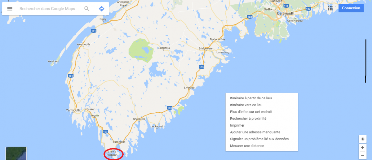
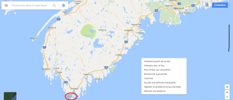
Le point rouge que j'ai mis serait tout proche d'Halifax...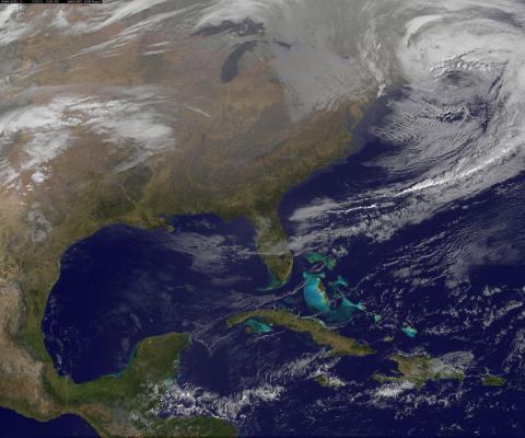
-
Observations du 13 au 19 fév 2017
Mizar a répondu à un(e) topic de beachcp31 dans Discussions générales
Je sais et c'est dans l'temps ou il allumait les feux de circulation avec des chandelles... -
DISCUSSIONS PRÉVISIONS du 20 au 26 fév 2017
Mizar a répondu à un(e) topic de beachcp31 dans Discussions générales
On verra bien d'ici-là...
-
Observations du 13 au 19 fév 2017
Mizar a répondu à un(e) topic de beachcp31 dans Discussions générales
Une belle photo de Fredericton prise il y a peu...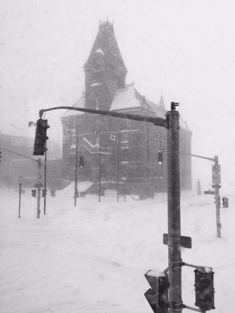
-
Observations du 13 au 19 fév 2017
Mizar a répondu à un(e) topic de beachcp31 dans Discussions générales
...
-
DISCUSSIONS PRÉVISIONS du 13 au 19 fév 2017
Mizar a répondu à un(e) topic de Trapper dans Discussions générales
Allo Dave !!! J'ai hâte de voir mais le hic sur cette événement manqué ou pas, c'est encore une fois la crête vers l'Ouest. C'est fort de valeur car la deuxième pièce d'énergie était bien placé. À suivre mais...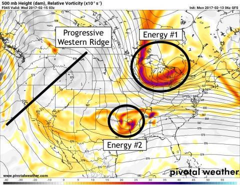
-
Observations du 13 au 19 fév 2017
Mizar a répondu à un(e) topic de beachcp31 dans Discussions générales
Bon matin !!! Petite neigeotte résiduelle qui tombe encore ce matin . -8°C. Idem de mon côté ... une belle bordée et les paysages sont encore plus beau ce matin. -
Notre Hiver Météorologique 2016-2017 .
Mizar a répondu à un(e) topic de Mizar dans Discussions générales
Ou bien tout cela va finir par un simple et banal L-C. Et je continu de croire que cette anomalie froide sera effectivement généré par le couvert neigeux des dernières tempêtes.. :-)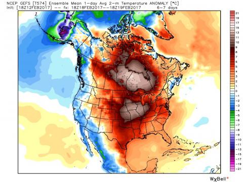
-
Observations du 6 au 12 fév 2017
Mizar a répondu à un(e) topic de Trapper dans Discussions générales
Pas de doute, ça commence a être du sérieux en N-É... Beer Store line up here in HRM ... no joke lol. -
Observations du 6 au 12 fév 2017
Mizar a répondu à un(e) topic de Trapper dans Discussions générales
Photo from Shoppers in Dartmouth N.S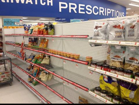

-
DISCUSSIONS PRÉVISIONS du 13 au 19 fév 2017
Mizar a répondu à un(e) topic de Trapper dans Discussions générales
Jeudi...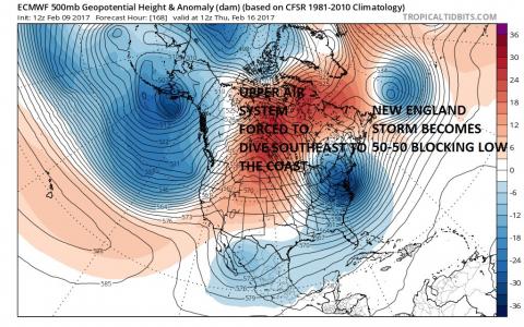
-
DISCUSSIONS PRÉVISIONS du 13 au 19 fév 2017
Mizar a répondu à un(e) topic de Trapper dans Discussions générales
Ici !!! :-) http://collaboration.cmc.ec.gc.ca/cmc/cmop/risk-forecast/latest/forecast.html -
DISCUSSIONS PRÉVISIONS du 13 au 19 fév 2017
Mizar a répondu à un(e) topic de Trapper dans Discussions générales
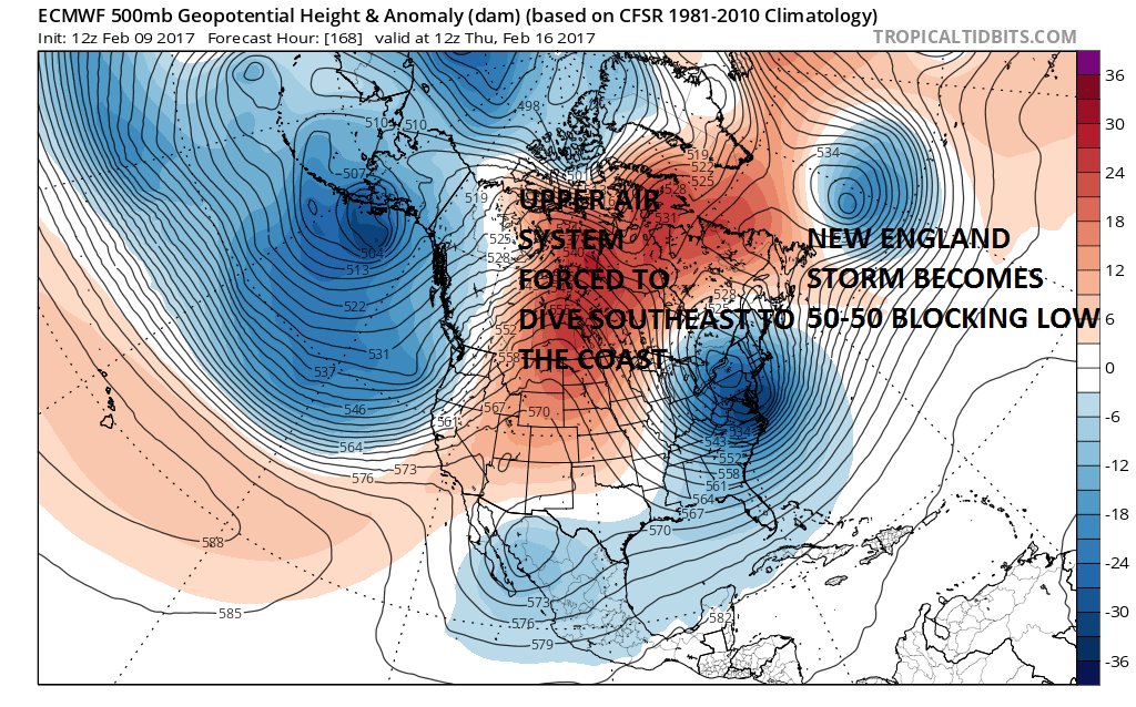
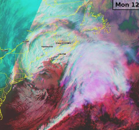
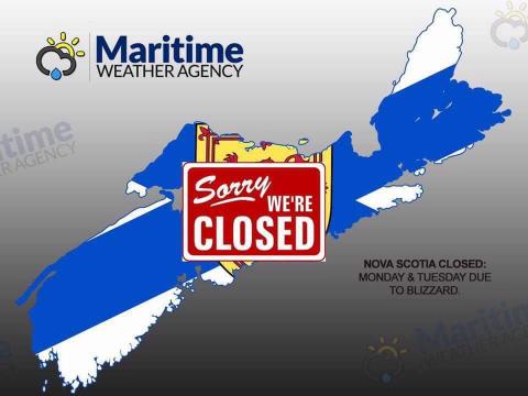
Early in the week, an atlantic bomb moving south of NS will give significant snowfalls and blowing snow with strong winds to half of the Maritimes on Monday spreading to southern and eastern Newfoundland on Tuesday before moving away from the island by mid week. Coastal flooding from storm surges will likely be a concern also over the Atlantic coast of NS and possibly for parts of PEI. . Another system is in store for Atlantic Canada by the end of the work week. That system though not as deep as the first system earlier in the week, should track farther west into the Gulf of Saint-Lawrence giving snow and blowing snow to the Maritimes and eastern QC while Newfoundland likely to experience a mix bag of precipitation with a risk of freezing rain for southeastern Newfoundland. There are uncertainties with the exact track of that later system so far in advance but there are indications for above normals precipitations for part of the Maritimes and for eastern Newfoundland. -
Observations du 6 au 12 fév 2017
Mizar a répondu à un(e) topic de Trapper dans Discussions générales
J'peux presque dire pour ne pas dire, que c'est pratiquement la tempête chez-moi @ 17h03 pm.