
Classement
Contenu populaire
Affichage du contenu avec la meilleure réputation le 2025-07-10 dans toutes les zones
-
Plus ou moins.. Vu justement le manque de force de vents en altitude et la forte instabilité, l'outflow et humidité restante de certaines cellules va influencer le déplacement d'autres cellules émergentes.1 point
-
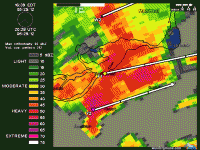
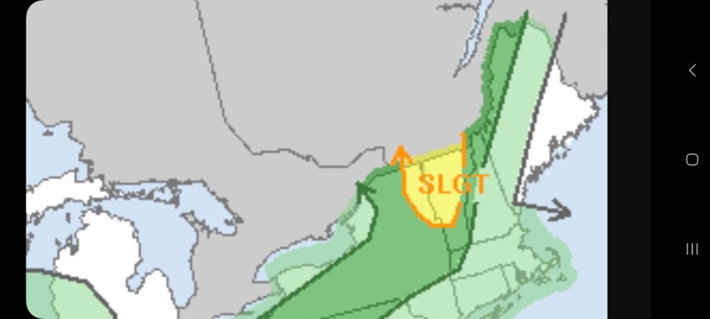
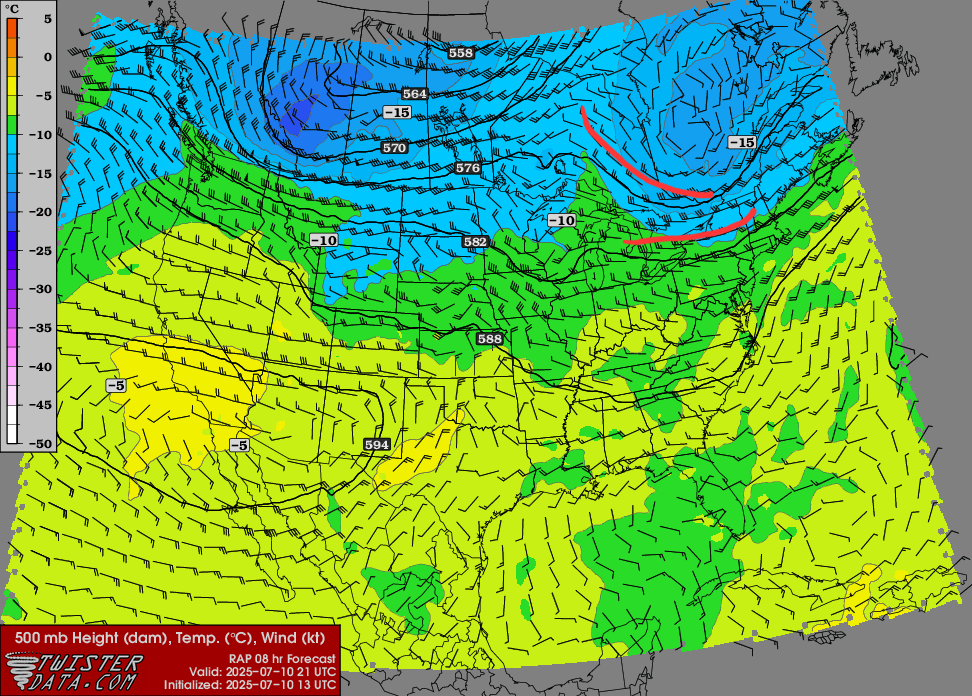
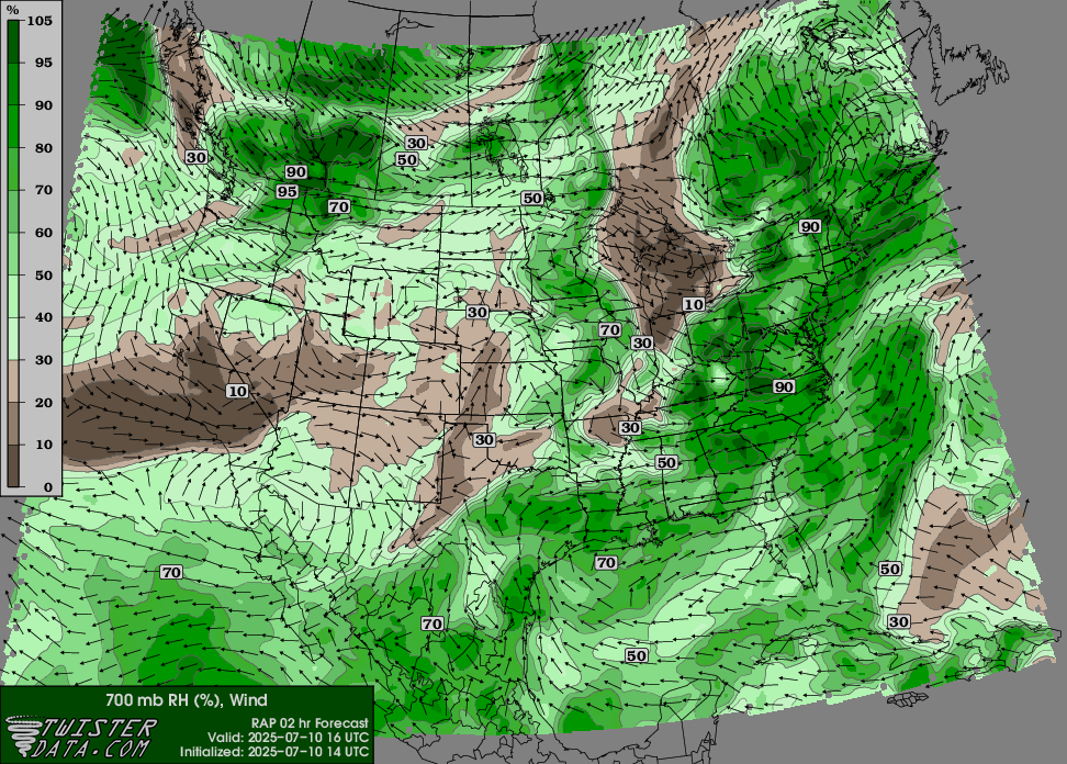
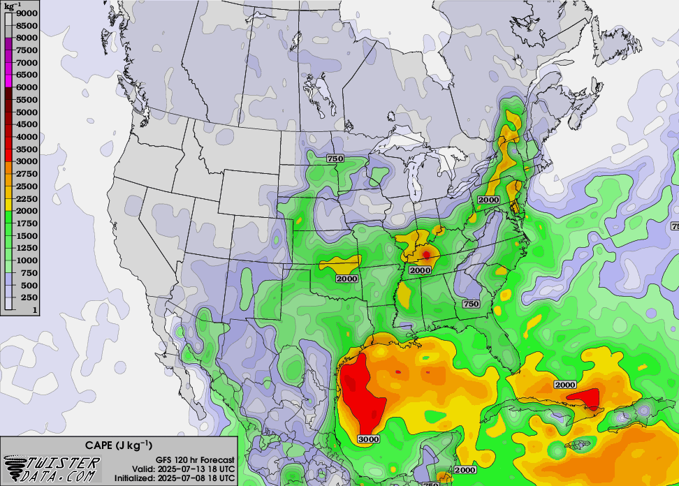
Petite surprise du SPC pour les secteurs de l'extrême sud du Québec aujourdhui.. Froid et humide en altitude donc possibilité de fortes pluies pouvant générer des micro-rafales et grêle dans les plus fortes cellules. ..New England and Upper Ohio Valley... A mid-level trough will continue to shift eastward over Quebec today, with the base of the trough and moderately strong cyclonic flow aloft overspreading northern New York and northern New England. Models indicate that scattered thunderstorm development is probable during peak afternoon heating, in the presence of moderate CAPE (1000-2000 J/kg) and shear enhanced at least somewhat by a belt of 20-30 kt westerly mid-level flow. Damaging winds and some hail will be possible regionally, but in particular across northeast New York and Vermont where a more favorable combination of instability/shear should exist near a weak surface wave/warm front.
 1 point
 -
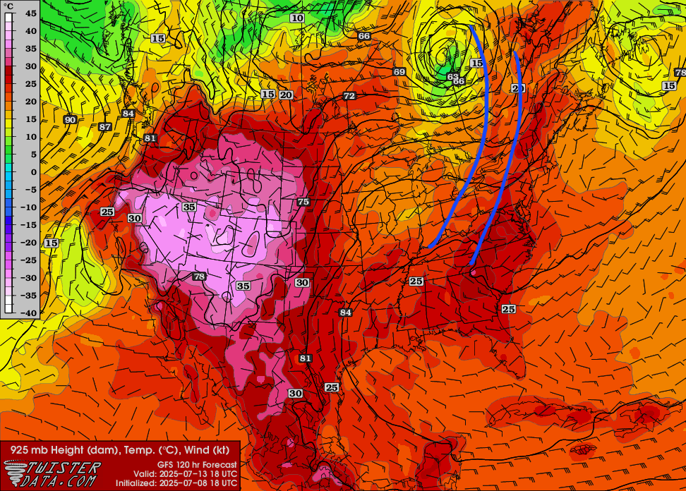
Potentiel de temps violent pour clore cette période de discussion ce Dimanche le 13. Voyons voir maintenant si la tendance se maintiendra dans le temps mais j'aime bien la dynamique présenté sur le GFS 18z.
 1 point
