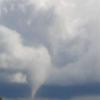
Pierre Posté(e) le 3 novembre 2006 Signaler Partager Posté(e) le 3 novembre 2006 (modifié) An unusual storm with the satellite appearance of a hurricane formed 900 miles off the coast of Oregon yesterday. The storm is a hybrid between a warm-cored tropical cyclone, cold-cored extratropical cyclone, and an uncommon type of winter storm called a Polar Low. Since we're not really sure how to classify this odd beast, I'll call it "Thingamabobbercane". Thingamabobbercane is being called 91C at the Navy web site. Figure 1. Thingamabobbercane forms 900 miles west of the Oregon coast, November 1, 2006. Thingamabobbercane formed from a cold-cored extratropical storm that spent two days drifting over relatively warm waters of about 59-61F (15-16C). These temperatures were warm enough to warm the core of the storm and generate a cloud-free "eye" and an "eyewall" of intense thunderstorms surrounding the eye. The spiral bands of showers and eye/eyewall appearance look very similar to Hurricane Epsilon of 2005, which formed over waters of 75-77 F (22-23C). If Thingamabobbercane had been in the Atlantic, it would likely have been given a name and called a subtropical cyclone. The Central Pacific Hurricane Center in Honolulu isn't even mentioning it in their Tropical Weather Outlook, so Thingamabobbercane is not going to get a name. Hybrid storms of this nature are rare in the Central Pacific, and we really don't know what to do with them. It's worth noting that SSTs in the northeast Pacific are a substantial 2 C above normal; normally ocean temperatures are too cold to get hybrid subtropical storms off the coast of Oregon. A QuikSCAT satellite pass from last night (Figure 2) shows wind speeds as high as 50 knots (57 mph) to the south of the circulation center of Thingamabobbercane. Cloud top temperatures in the "eyewall" were between -42 and -53 C, which correspond to heights of 35,000 to 40,000 feet. Satellite imagery from this morning shows that Thingamabobbercane has weakened, and resembles a donut with the bottom half missing. Wind shear, which was 15 knots yesterday, has increased to 25 knots over the storm, and is likely responsible for the weakening. Thingamabobbercane is expected to gradually weaken as it drifts northeastward over the next two days. The storm will make the transition to a regular extratropical cyclone by Saturday, and affect British Columbia with gale-force winds early next week. Tiré du blogue de Dr. Jeff Master sur Wunderground... Modifié le 3 novembre 2006 par Pierre Citer Lien vers le commentaire Share on other sites More sharing options...
Mizar Posté(e) le 3 novembre 2006 Signaler Partager Posté(e) le 3 novembre 2006 Thingamabobbercane; j'ai fait une recherche dans Wikipedia... et ce mot la n'existe pas. si cela aurait ete l'Hiver serait pu etre le petit coussin de la "toboggan" Citer Lien vers le commentaire Share on other sites More sharing options...
Baromètre Posté(e) le 3 novembre 2006 Signaler Partager Posté(e) le 3 novembre 2006 On aura tout lu Citer Lien vers le commentaire Share on other sites More sharing options...
meteomarc Posté(e) le 4 novembre 2006 Signaler Partager Posté(e) le 4 novembre 2006 Lol J'avais vu ca sur Wunderground tropical, le blog de jeff master ...J'avais fait le saut en voyant ca...tout de meme etrange ce systeme pareil comme un ouragan! Citer Lien vers le commentaire Share on other sites More sharing options...

Recommended Posts
Rejoindre la conversation
Vous pouvez publier maintenant et vous inscrire plus tard. Si vous avez un compte, connectez-vous maintenant pour publier avec votre compte.