
Classement


Contenu populaire
Affichage du contenu avec la meilleure réputation le 2023-07-28 dans toutes les zones
-
De juste éliminé l'humidité de l'équation pendant un certain temps....c'est déjà une petite bénédiction !!!! Bonne journée !!! ;-)2 points
-
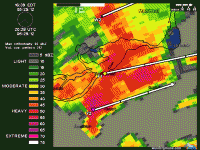
Discussion du SPC concernant le "setup" dans le Sud du Québec: Northern ME... Widely scattered to scattered thunderstorms are expected to develop along/ahead of a cold front over southern QC, upshear from this region, during the afternoon. Some of this activity may cross northern ME before weakening, with the potential for isolated, marginally severe gusts and/or hail. Forecast soundings suggest a combination of diurnal heating and sufficient moisture (e.g., mid-60s F surface dewpoints) will offset modest mid/upper-level lapse rates and yield around 1000 J/kg MLCAPE. Nearly unidirectional deep-layer wind profiles will limit low-level shear, but with strong flow in mid/upper levels, effective-shear magnitudes around 35-45 kt reasonably appear in modeled wind profiles, prior to convective influences. As such, organized multicells and isolated supercells may occur.1 point
-
C'est bien sûr possible, tout ce qui vient avec un orage violent. J'ai déjà déjà vu des situations avec un bien meilleur potentiel au fil des années... mais ça pourrait être bien actif demain. Il reste à voir où exactement et si le potentiel tient jusqu'à demain sur les modélisations.1 point