
Classement

Contenu populaire
Affichage du contenu avec la meilleure réputation le 2024-04-11 dans toutes les zones
-
Je t'expliquerais.1 point
-
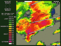
Le tonnerre a été surprenant tantôt. C'est passé par chez moi. Je ne m'attendais vraiment pas à ça. Belle cellule, et comme tu le dis, elle est restée intacte... Il a plu, plu très fort par moment, avec quelques éclairs, mais comme tu le dis on est encore au début de la saison...1 point
-
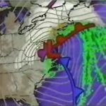
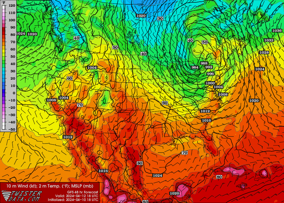
Notre premier setup orageux potentiel de la saison pour l'Estrie/Bois-Francs/Québec Vendredi le 12 Avril? Extrait de la discussion du SPC côté américain: East... Deep surface cyclone near Lake Huron at 12Z Friday should occlude and slowly weaken as it continues northeastward into western Quebec. The arcing occluded front across parts of the Northeast may be a focus for low-topped convection during the late morning to early afternoon. Surface-based destabilization appears to be rather limited, but its plausible that scant to meager buoyancy might develop over the eastern NY vicinity. Low to deep-layer wind profiles are conditionally favorable for organized updrafts and this corridor will need to be monitored in later outlooks for a potential cat 1-MRGL risk highlight.
 1 point