


iceberg
-
Compteur de contenus
1 349 -
Inscription
-
Dernière visite
-
Jours gagnés
47
Type de contenu
Profils
Forums
Events
Gallery
Tout ce qui a été posté par iceberg
-
Prévisions et observations Samedi 25 Juillet
iceberg a répondu à un(e) topic de marcrem dans Discussions générales
2 DAILY RECORDS BROKEN ALREADY FOR A JULY 25 2009... 16.1°C 1950 OLD RECORD FOR ALERT...NUNAVUT 17.3C RIGHT NOW.... 23.9°C 1969 OLD RECORD FOR IQALUIT.... NUNAVUT 24.1C RIGHT NOW..... -
Prévisions et observations Samedi 25 Juillet
iceberg a répondu à un(e) topic de marcrem dans Discussions générales
RECORDS FOR DAILY MAX TEMP WILL FALL TODAY ON BAFFIN ISLAND...... RECORD IS 26.1C SET IN 2003 ON JULY 29...... POSSIBLE THUNDER STORM FOR RESOLUTE..... -
So far for Southern Quebec the year without a summer continues just like i said a few weeks ago and it will continue into August, sorry for saying this but the models will change there tune very soon and it does not look good... I will give more details soon on this....
-
PRÉVISIONS ET OBSERVATIONS 17 JUILLET 09
iceberg a répondu à un(e) topic de Pierre dans Discussions générales
EF-0 TORNADO CONFIRMED IN ORANGE COUNTY....... http://forecast.weather.gov/product.php?si...BTV&product=PNS -
Sunspots and volcanic activity do affect the weather.
-
Let's hope Mr. Bastardi is right ! SO FAR HIS SUMMER FORCAST IS RIGHT ON THE MONEY !!!
-
Well it really looks like this summer will go down beside the summers of 1992 and 1986 . No big heat waves in sight even for the 2 week contruction holiday .With no sunspot activity and volcanic ash more present in the atmosphere may be the cause for this i really think so.
-
It looks like el nino will not have a profound affect on our climate for the 2009-10 winter season as it will wane slowly by the time winter sets in. Accuweather Joe B. has some good points on this matter. LINK... http://www.accuweather.com/news-weather-fe...s.asp?#extremes
-
PRÉVISIONS / OBSERVATIONS 13 JUILLET 2009
iceberg a répondu à un(e) topic de QcMart dans Discussions générales
Current - Courant - Observation : 22:34PM EST JULY 13, 2009. Place: Montreal-East Obs: Cloudy Temp: 15.5c Hudex: NIL Dew: 7.0c Wchill: 15.5.c Hum: 57% Wind: 3.6km/h NW Gust: 5.0km/h Pres: 1011.1 hpa ® Rain: 3.6mm last 24 hours WEATHER NOTES : IT WAS A RAW COOL DAY TODAY FOR JULY STANDARDS. WE ALMOST BROKE THE MAX MIN FOR TODAYS DATE. THE RECORD WAS SET IN 1986 AT 17.9C. THE COOL PATTERN WILL CONTINUE FOR THIS WEEK. THE YEAR WITHOUT A SUMMER CONTINUES. HERES A LINK TO WHATS HAPPENING ELSE WHERE......... http://iceagenow.com/ -
PRÉVISIONS ET OBSERVATIONS 11 JUILLET 09
iceberg a répondu à un(e) topic de Pierre dans Discussions générales
Current - Courant - Observation : 22:22PM EST JULY 11, 2009. Place: Montreal-East Obs: Cloudy Temp: 17.3c Hudex: 20.8c Dew: 14.2c Wchill: 17.2.c Hum: 83% Wind: 8.6km/h WSW Gust: 13.3km/h Pres: 1007.0 hpa (S) Rain: 30.6mm last 24 hours -
Prévisions et observations du 3 juillet 09
iceberg a répondu à un(e) topic de tornado_master dans Discussions générales
Current - Courant - Observation : 6:02AM EST JULY 3, 2009. Place: Montreal-East Obs: Cloudy Temp: 18.4c Hudex: 22.9c Dew: 16.0c Wchill: 18.4.c Hum: 86% Wind: 1.1km/h SW Gust: 3.6km/h Pres: 1006.8 hpa (f) Rain: 0.0mm last 24 hours Weather notes: The year without a summer continues. The overall pattern is the same for the next 7 days . We might get a few days of above normal temps late next week but still no sign of any heat waves, by the way Grise Fiord 5 cm of snow today.. -
PRÉVISIONS ET OBSERVATIONS 1ER ET 2 JUILLET 09
iceberg a répondu à un(e) topic de Pierre dans Discussions générales
THUNDERSTORM CELLS SLOWLY INVADING THE WESTERN TIP OF THE ISLAND..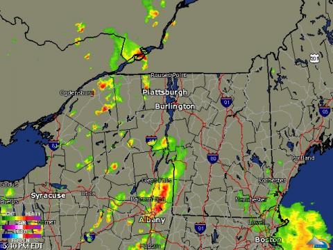
-
PRÉVISIONS ET OBSERVATIONS DES 29 ET 30 JUIN 09
iceberg a répondu à un(e) topic de Pierre dans Discussions générales
METRO MONTREAL - LAVAL 8:37 PM EDT TUESDAY 30 JUNE 2009 SEVERE THUNDERSTORM WATCH FOR METRO MONTREAL - LAVAL CONTINUED Montréal métropolitain - Laval 20h37 HAE le mardi 30 juin 2009 une veille d'orages violents pour le Montréal métropolitain - Laval est maintenue -
PRÉVISIONS ET OBSERVATIONS DES 29 ET 30 JUIN 09
iceberg a répondu à un(e) topic de Pierre dans Discussions générales
Current - Courant - Observation : 22:28PM EST JUNE 29, 2009. Place: Montreal-East Obs: Partly Cloudy Temp: 19.4c Hudex: 24.3c Dew: 16.6c Wchill: 19.4.c Hum: 84% Wind: 2.5km/h NW Gust: 6.1km/h Pres: 998.6 hpa ® Rain: 34.8mm since 4:00AM WEATHER NOTES: HUMID WEATHER AND RAIN IS THE HEADLINE FOR MONTREAL AND AREA AND WILL CONTINUE THIS WEEK AS LOW PRESSURE SYSTEM STALLS OVER THE GREAT LAKES WHILE HUGE HIGH PRESSURE AREA OVER NEW FOUNDLAND PARKS ITS SELF.EXPECT TEMPS TO BE STABLE DURING THE PERIOD.EXPECT TEMP TO REBOUND NEXT WEEK BUT ANOTHER LOW PRESSURE WILL PAY A VISIT AGAIN.STAY TUNED..... -
PRÉVISIONS ET OBSERVATIONS DES 29 ET 30 JUIN 09
iceberg a répondu à un(e) topic de Pierre dans Discussions générales
MONTREAL- EAST STATION 34.2mm fell since 6am. A burst of 9.9mm fell from 11am to 12pm. I will update the totals in my 22:00 pm report. -
There is more ice then in 2007 this year. But still far away from the 1979 to 1989 average.There is nothing to get excited about !!!! http://arctic.atmos.uiuc.edu/cryosphere/IM...VE/19790627.png
-
Current - Courant - Observation : 22:19PM EST JUNE 25, 2009. Place: Montreal-East Obs: Cloudy Temp: 26.3c Hudex: 33.0c Dew: 19.5c Wchill: 26.3.c Hum: 66% Wind: 1.1km/h W Gust: 5.0km/h Pres: 1002.9 hpa (S) Rain: 1.8mm since 14:00PM
-
Current - Courant - Observation : 16:51PM EST JUNE 25, 2009. Place: Montreal-East Obs: Mainly Sunny Temp: 30.7c Humi: 34.9c Dew: 17.8c Wchill: 30.2.c Hum: 40% Wind: 22.0km/h W Gust: 27.0km/h Pres: 1002.9 hpa (F) Rain: NIL since 00:00AM
-
Current - Courant - Observation : 21:43PM EST JUNE 22, 2009. Place: Montreal-East Obs: CLEAR Temp: 21.3c Dew: 13.0c Wchill: 20.2c Hum: 59% Wind: 6.8km/h SE Gust: 15.8km/h Pres: 1012.2 hpa ® Rain: NIL since 00:00AM WEATHER NOTES : A WIND GUST OF 49.0KM/H WAS OBSERVED AT 14:23 PM.
-
Observations 15 juin au 21 juin
iceberg a répondu à un(e) topic de shawn_strat dans Discussions générales
Current - Courant - Observation : 6:02AM EST JUNE 21, 2009. Place: Montreal-East Obs: Cloudy Temp: 18.7c Dew: 15.8c Wchill: 18.7c Hum: 83% Wind: 2.5km/h SE Gust: 6.1km/h Pres: 1004.6 hpa ® Rain: NIL since 00:00AM -
Observations 15 juin au 21 juin
iceberg a répondu à un(e) topic de shawn_strat dans Discussions générales
Current - Courant - Observation : 5:52AM EST JUNE 20, 2009. Place: Montreal-East Obs: Cloudy Temp: 16.8c Dew: 14.1c Wchill: 16.8c Hum: 84% Wind: 2.5km/h NNE Gust: 5.0km/h Pres: 1007.3 hpa (F) Rain: NIL since 00:00AM WEATHER NOTES : 12.0MM OF RAIN FELL FOR JUNE 18, 2009. 1.2MM OF RAIN FELL FOR JUNE 19, 2009. TOTAL OF 13.2MM FOR THE 2 DAYS. -
Observations 15 juin au 21 juin
iceberg a répondu à un(e) topic de shawn_strat dans Discussions générales
Current - Courant - Observation : 21:07PM EST JUNE 18, 2009. Place: Montreal-East Obs: Light rain Temp: 15.2c Dew: 13.1c Wchill: 15.2c Hum: 87% Wind: 6.1km/h S Gust: 12.2km/h Pres: 1012.6 hpa (F) Rain: 11.7MM since 13:00PM -
Observations 15 juin au 21 juin
iceberg a répondu à un(e) topic de shawn_strat dans Discussions générales
Current - Courant - Observation : 22:01PM EST Place: Montreal-East Obs: Mainly clear Temp: 21.8c Dew: 11.8c Wchill: 21.8c Hum: 53% Wind: 2.5km/h S Gust: 7.2km/h Pres: 1021.4 hpa ® Rain: NIL since 00:00AM -
LINK MAP FOR ICE DATA....AND YES INDEED THE ICE HAS BEEN STUBBORN THIS YEAR FOR HUDSON BAY.... http://arctic.atmos.uiuc.edu/cryosphere/NE...e.color.004.png
-
Observations 15 juin au 21 juin
iceberg a répondu à un(e) topic de shawn_strat dans Discussions générales
Current - Courant - Observation : 20:46PM EST Place: Montreal-East Obs: Cloudy with very light rain Temp: 15.5c Dew: 12.6c Wchill: 14.6c Hum: 82% Wind: 7.2km/h SE Gust: 12.2km/h Pres: 1018.7 hpa ® Rain: 10.5mm since 16:00pm Weather notes : At 16:37pm temp was 25.9c and dropped 8.8 degrees in 1 hours time as the thunderstorm cell passed over St. Leonard.Highest gust was clocked at 37.8km/h from the SE.Total rainfall at 10.5mm as of 20:46pm.
